 Sunreach
PRESS KIT
Sunreach for the press.
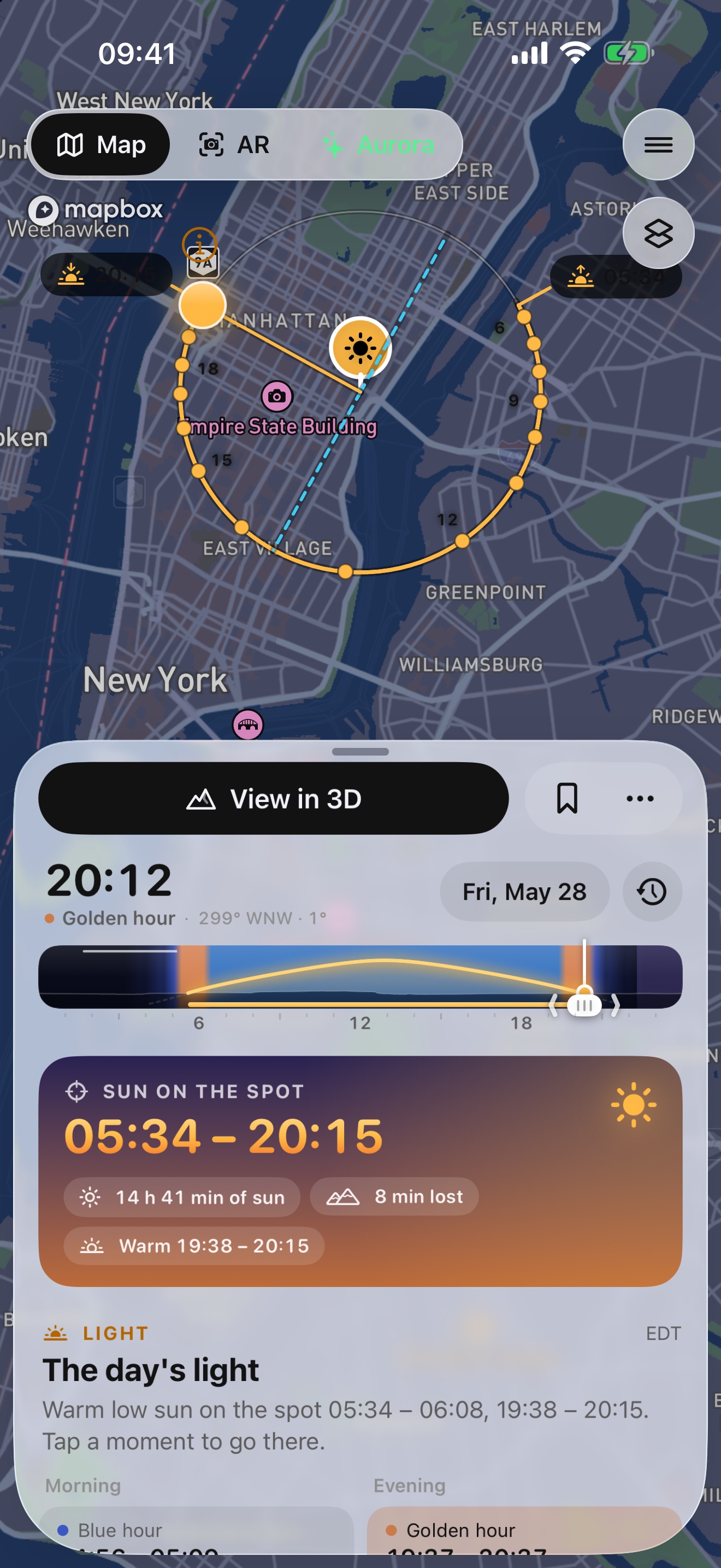
Sunreach tells photographers and travelers when the sun really reaches a spot and when it leaves, with the mountains and hills around it counted. Plan any place on a map, see the light in 3D, see the sun's path over the camera view in AR where you stand, and know whether tonight's aurora clears your skyline.
Fact sheet
- App
- Sunreach
- What it is
- The 3D and AR sun tracker over real terrain
- App Store name
- Sunreach: Sun & Aurora Planner (subtitle: Golden hour, 3D shade & AR)
- Developer
- Jaka Azman s.p., Domžale, Slovenia
- Platform
- iOS 26 or later (iPhone and iPad)
- Availability
- Coming soon to the App Store
- Price
- Free to download. Sunreach Pro at launch: €24.99 a year with a 7-day free trial, or €3.99 a month
- Language
- English
- Website
- sunreach.app
- Press contact
- azman.jaka@gmail.com
About the app
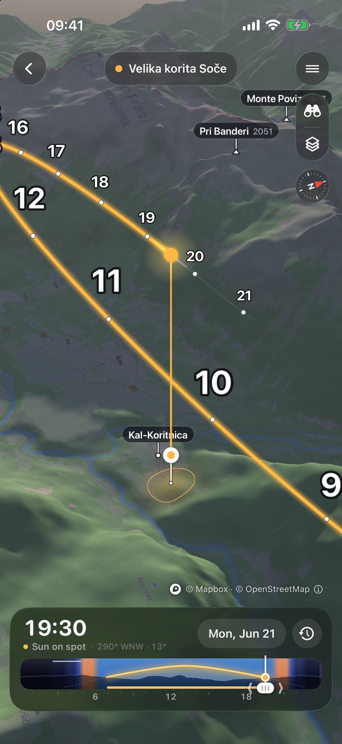
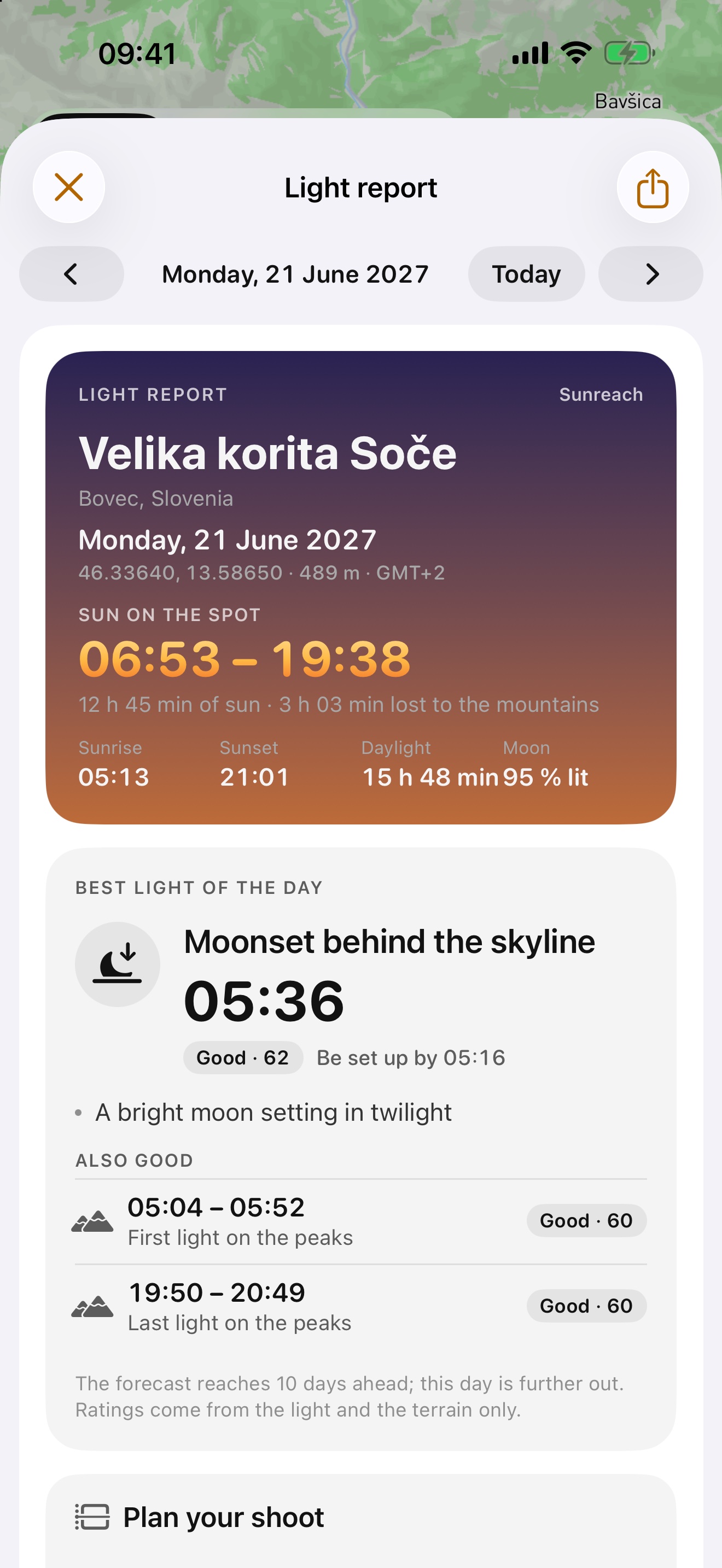
Weather apps give sunrise and sunset for a flat horizon. In the mountains, in a valley or between tall buildings that answer can be hours off. Sunreach reads the terrain around the spot, traces its real skyline and works out the minutes the sun reaches it and leaves it, for any day of the year.
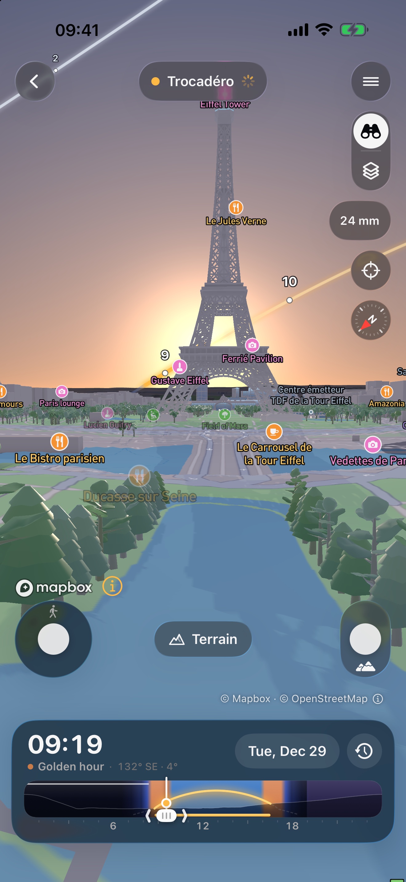
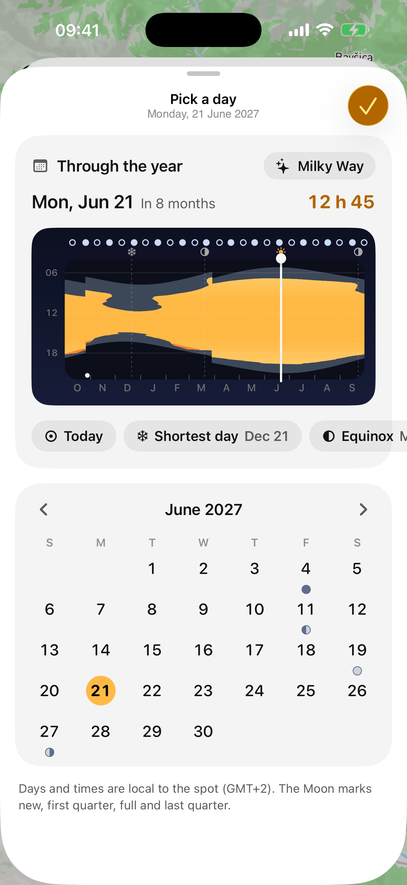
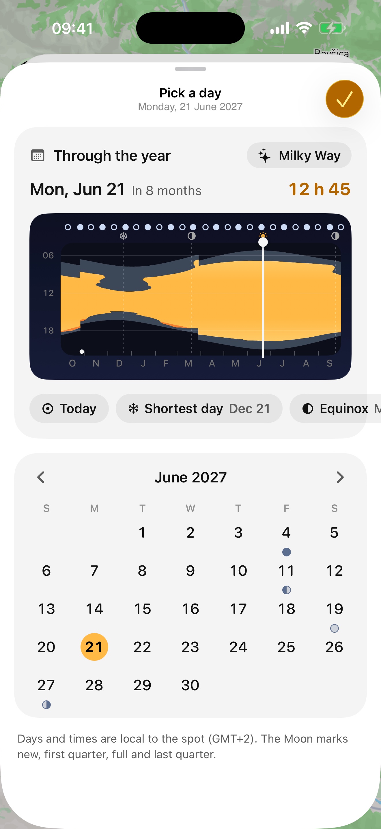
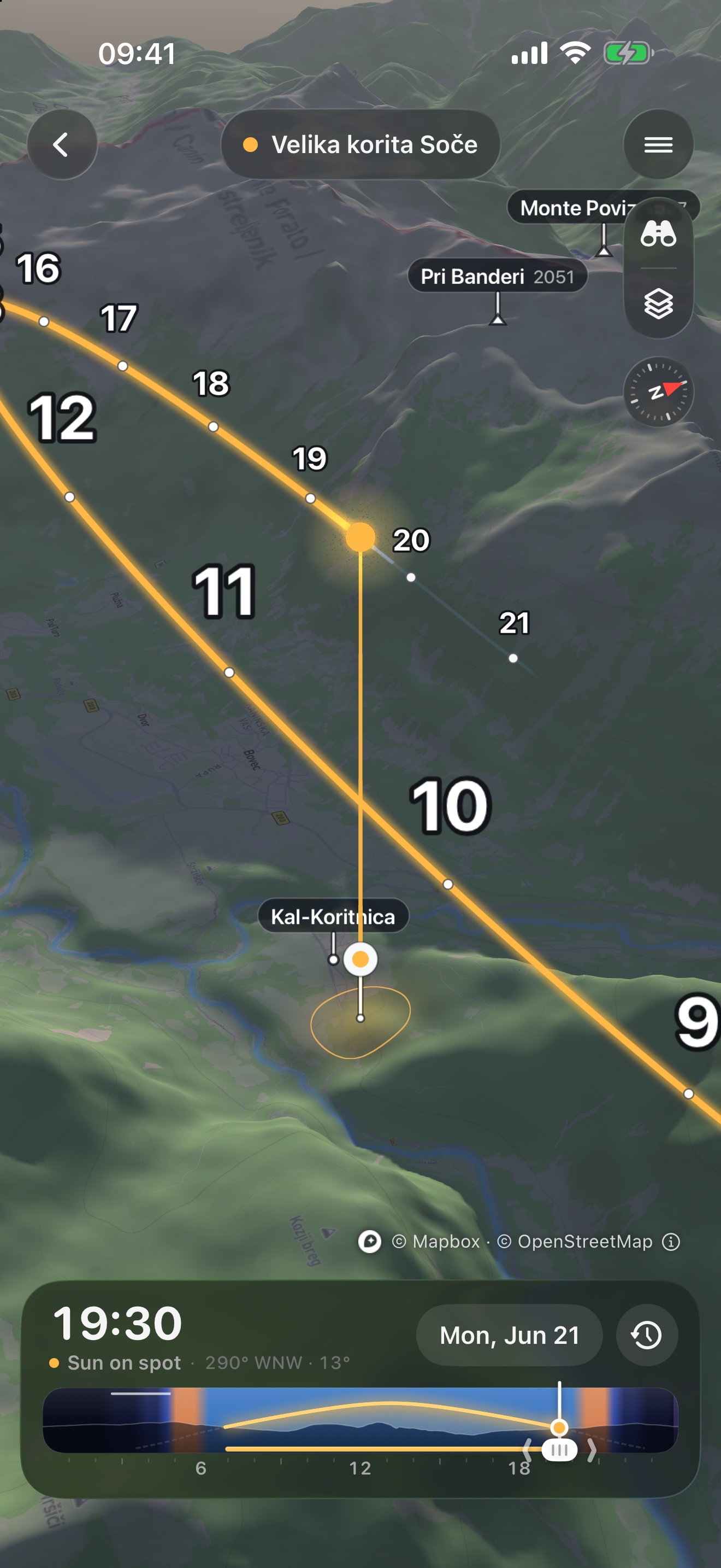
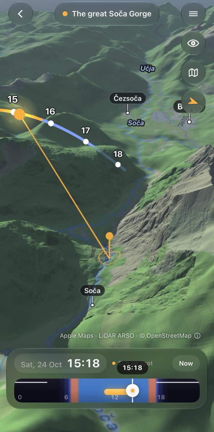
Search for a place or touch and hold the map. The plan shows sun on the spot, golden and blue hour, the sun's path against the skyline, twelve months of light in one chart, and the weather, with the peaks that keep the last light after sunset and a valley-fog outlook. The 3D view turns the terrain with moving shadows, an eye-level view you can walk with any lens, a drone camera, and a city view with buildings; AR draws the sun's path and the skyline over the camera where you stand.
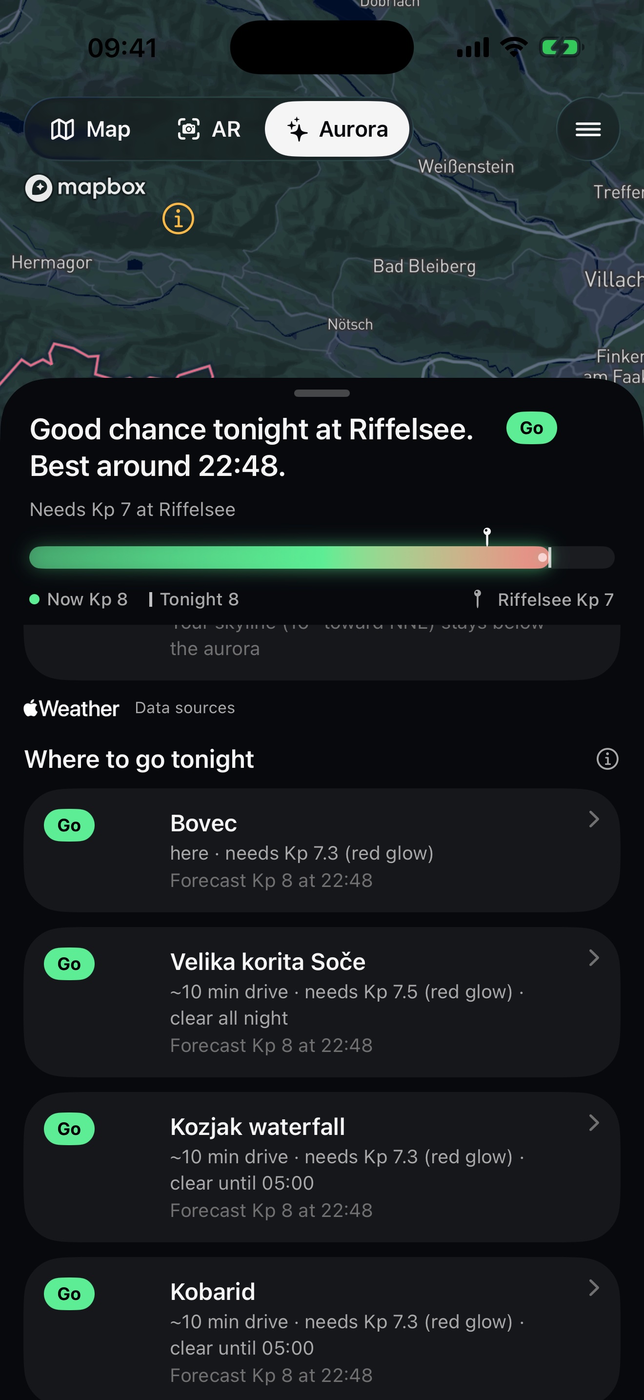
The aurora gets the same treatment. Aurora apps give the Kp; Sunreach says whether that Kp is enough for the spot, with the mountains toward the magnetic pole counted, the red glow of big storms that reaches far south, and the oval's turn through the night toward magnetic midnight. An Aurora tab beside the map shows NOAA's live oval on a night globe, a slider that plays the next three days, the story from the Sun's wind to tonight, and the spots within a drive that clear it tonight; alerts and a widget follow it.
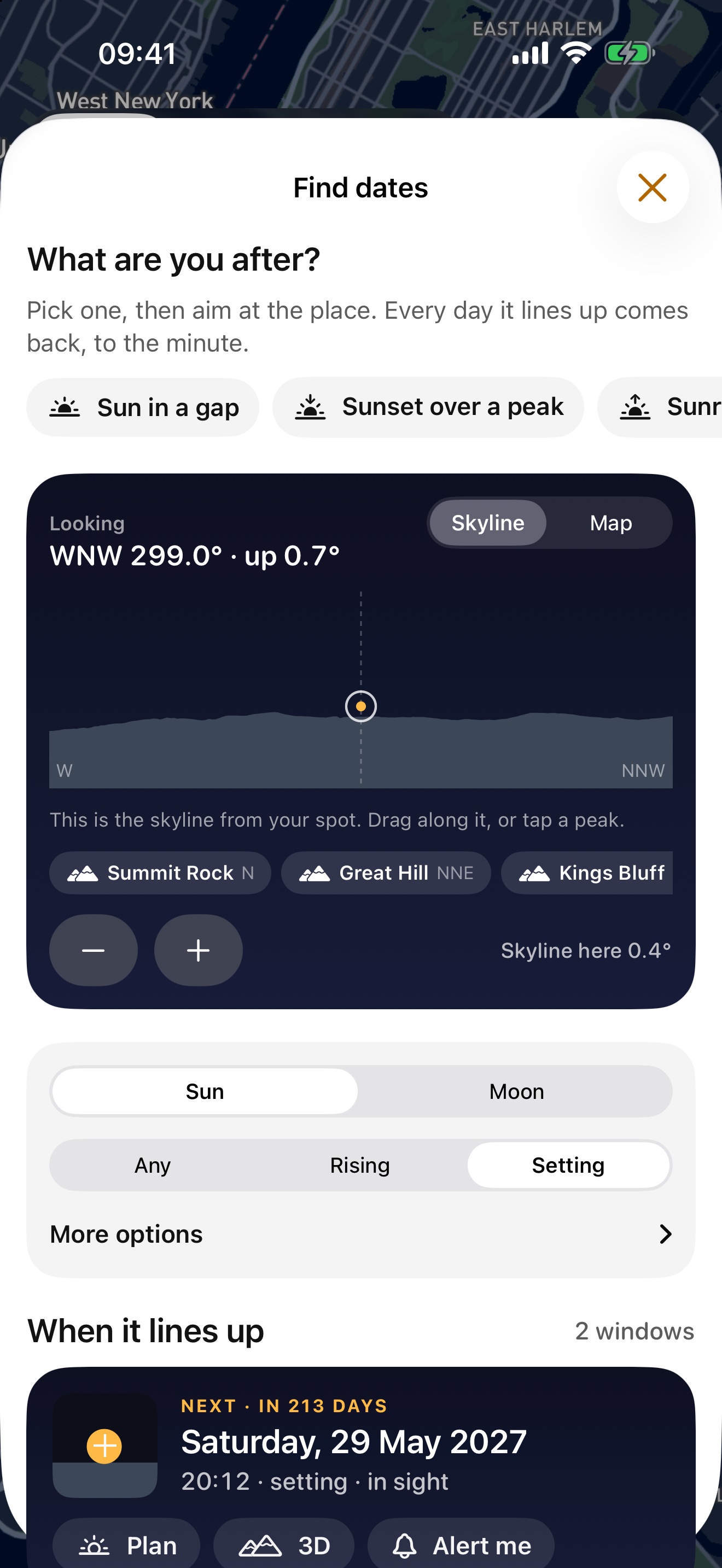
Alignment search turns the question around: pick a street, a notch on the ridge or a tower, and Sunreach lists the days and minutes the sun or moon lines up with it. It finds Manhattanhenge, and the winter mornings the sun passes behind the Eiffel Tower seen from Trocadéro.
Everywhere it uses 40 m terrain. In Switzerland, Spain, the Netherlands, Flanders, Czechia, Poland, Norway, Finland, Estonia, four German states, most of the USA and parts of Slovenia, France, Austria and Italy it uses laser-scan ground models at 2 to 5 m. Trees and buildings are not counted for now. There are no accounts and no ads, and the sun and skyline are computed on the device. Sunreach is free to plan today and tomorrow; Sunreach Pro plans any date.
The story
Sunreach started in the Soča valley in Slovenia. On 18 October 2026 the sun rises at 07:27 over a flat horizon, but it first reaches the water in the Velika korita gorge at 10:27 and leaves it at 14:59. A flat-horizon sunrise time says nothing about that, so the developer built an app that reads the gorge walls.
The same question comes up in every valley town, under every north face and on every city street: will the light be there when I am? Sunreach answers it to the minute.
Key features
- Sun on the spot: the minutes direct sun reaches and leaves a place, with the terrain counted
- The sun’s path against the real skyline, and twelve months of light in one chart
- Golden hour and blue hour for the spot
- 3D terrain with moving shadows, an eye-level view you can walk with lenses from 16 to 400 mm, and a drone camera with hyperlapse
- 3D city view with buildings and their shadows for the minute you pick
- Alignment search: the days and minutes the sun or moon lines up with a street, a skyline notch or a tower
- Peak light after sunset (which summits stay lit, go or don’t go) and a valley-fog outlook, from Apple Weather
- Polariser guide: where a polarising filter darkens the sky most, whether the forecast cloud leaves it worth using, and the band in AR and 3D
- Photo spots: 1,036 hand-picked viewpoints on every continent, each with a tip for the light
- Photo events: 98 light events worth a trip on every continent (alignments, mountain shade, midnight sun, meteor showers, moonbows, sea fog, lantern festivals), each explained
- Aurora forecast for your spot: NOAA’s live oval on a night globe, the Kp the spot needs over its own skyline (red glow of big storms counted), the best hour from the oval’s turn toward magnetic midnight, a three-day time slider, where to drive tonight, aurora alerts and a widget
- Moon phases, terrain-aware moonrise, dark-sky windows and the Milky Way, drawn in detail in 3D and AR
- AR: the sun’s path and the skyline over the camera view where you stand, with photo and video capture
- Laser-scan (lidar) ground at 2–5 m in supported countries; trees and buildings not counted for now
- Light alerts before golden hour or when the sun reaches a saved spot
- Home Screen and Lock Screen widgets, a Live Activity and an Apple Watch app
- Offline maps for trips without signal
- No account, no ads
Where the laser-scan data comes from and how far it reaches: Attributions and coverage.
Logo and icon


Header
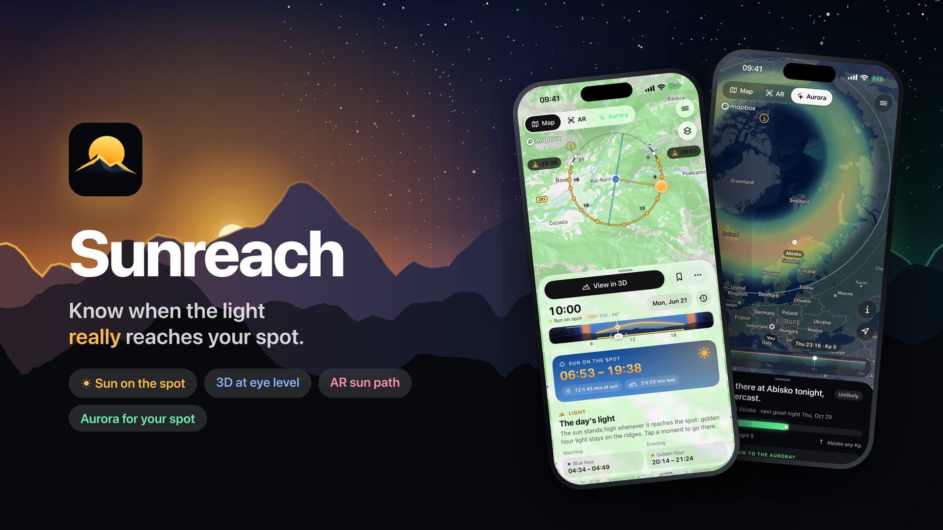
Screenshots
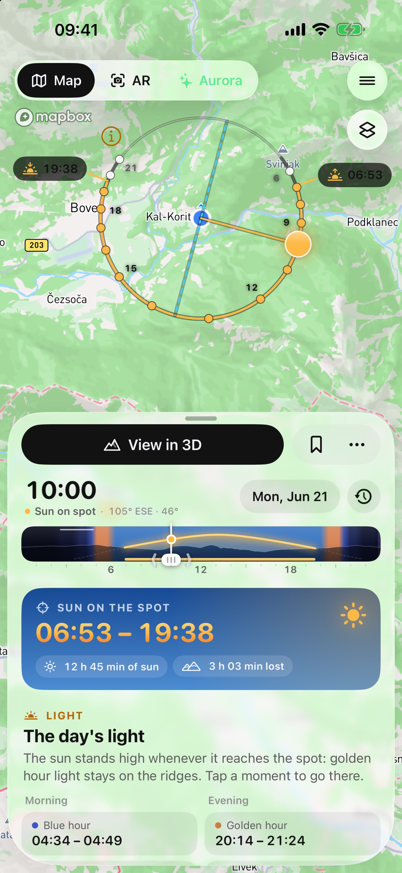
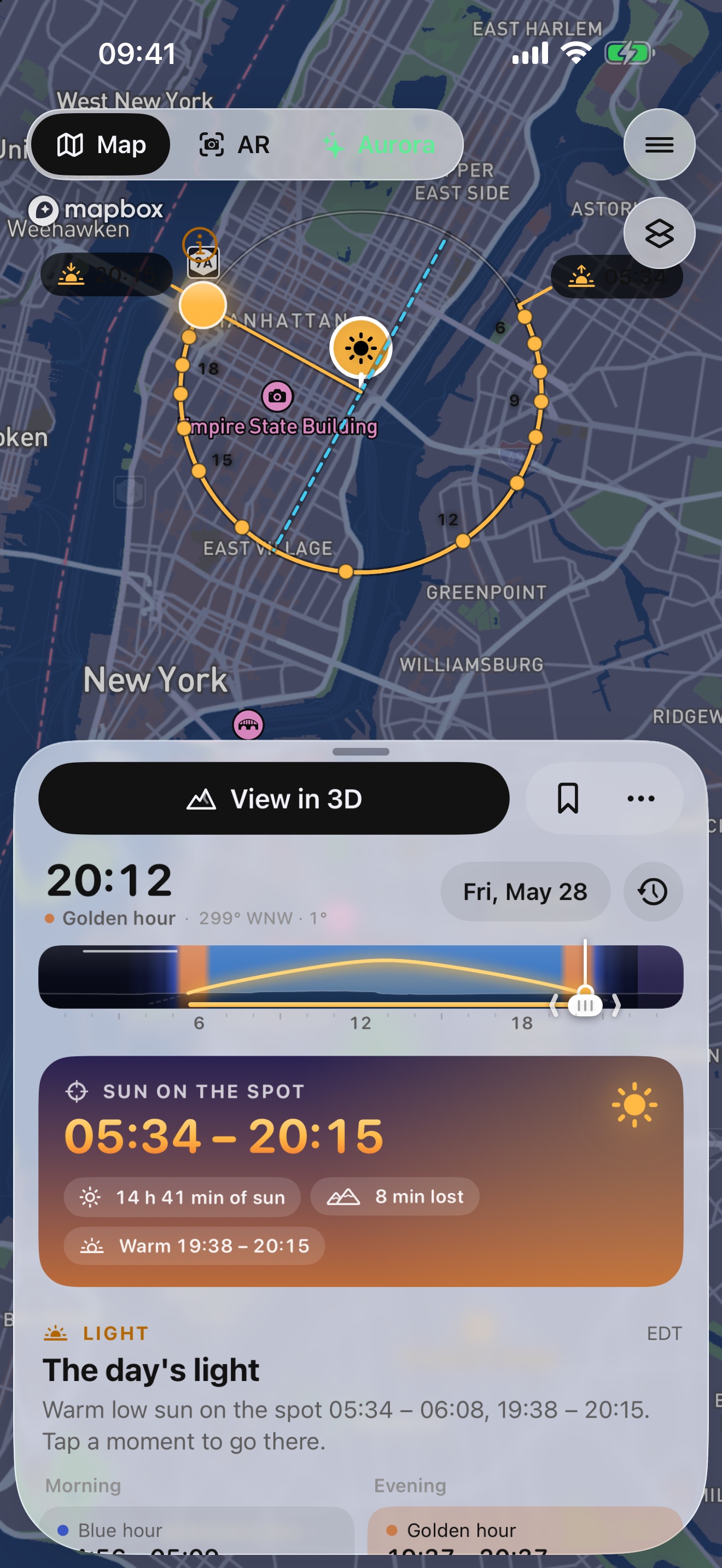
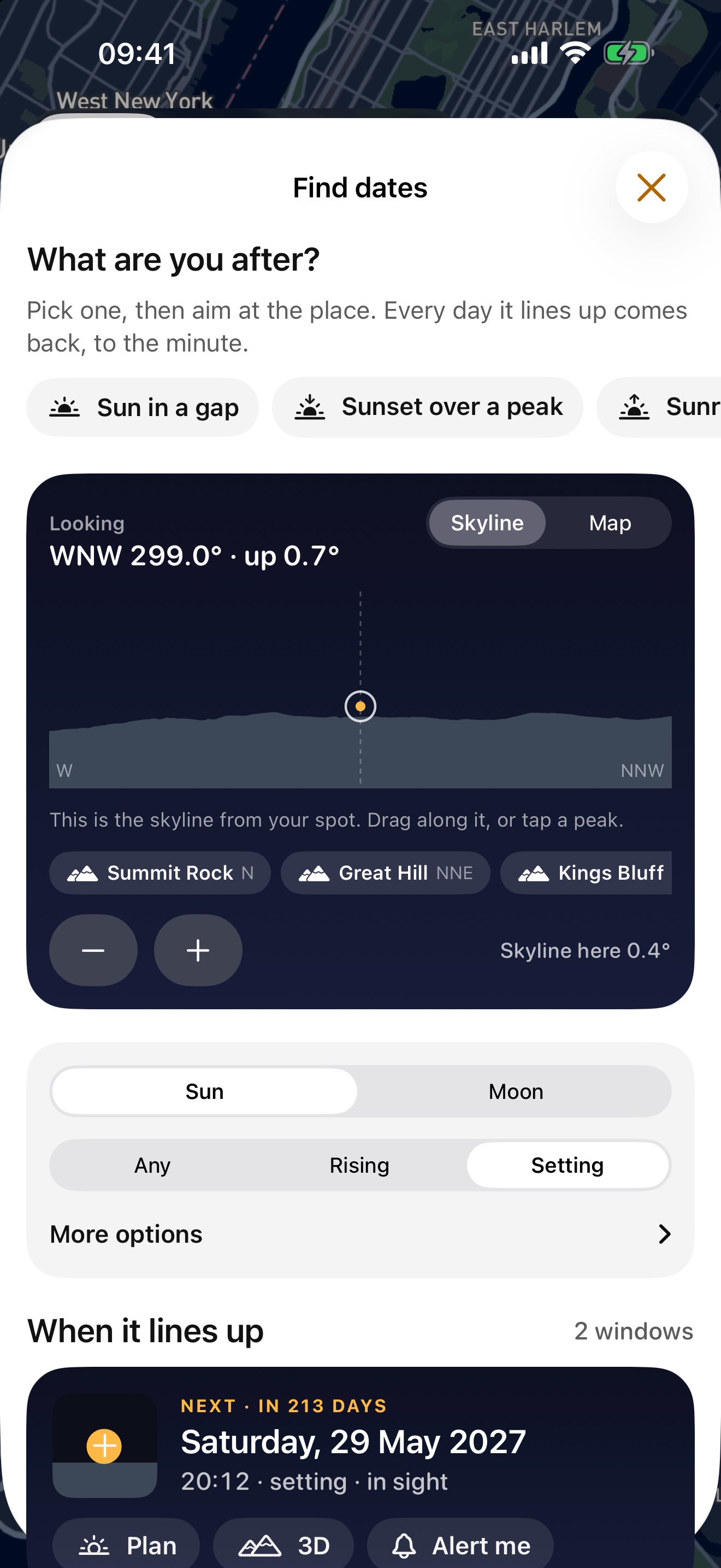
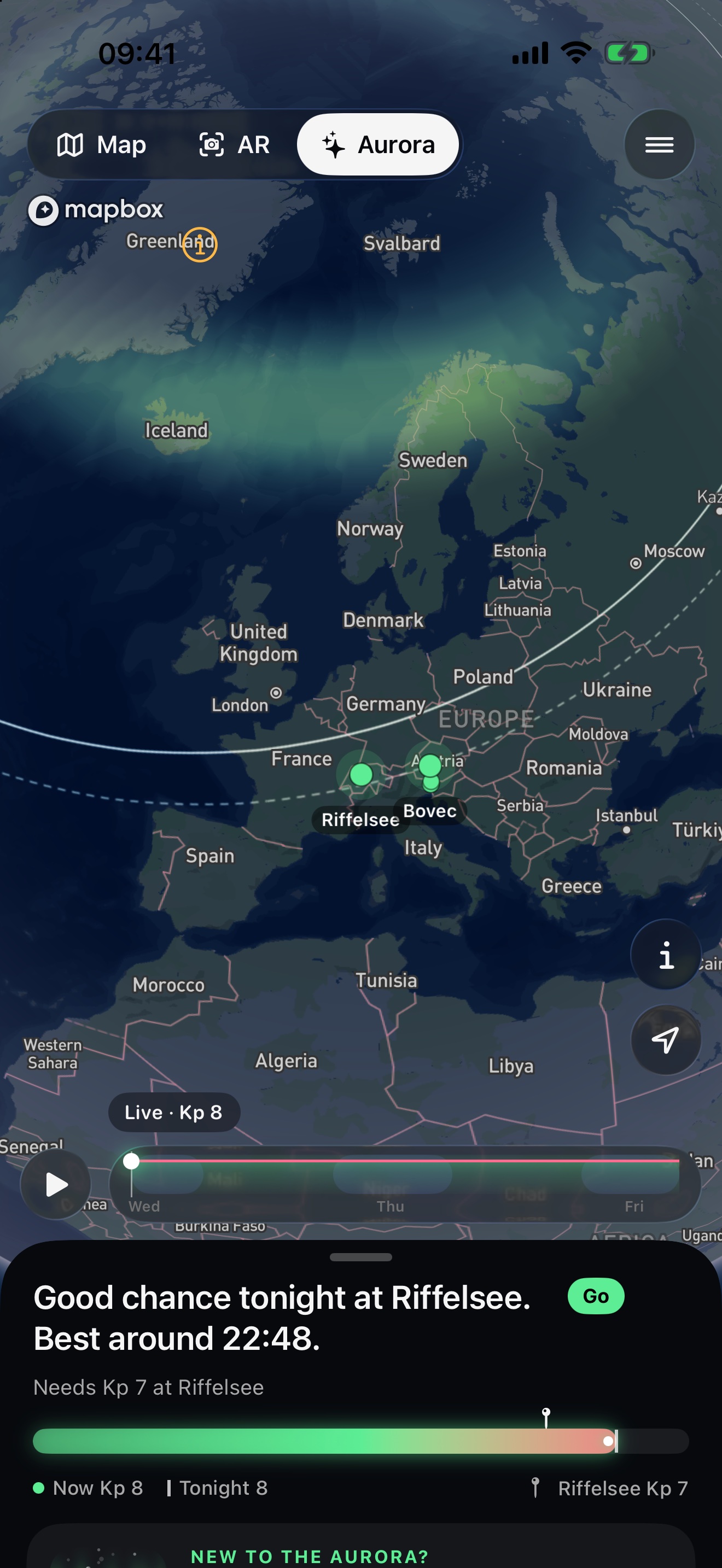
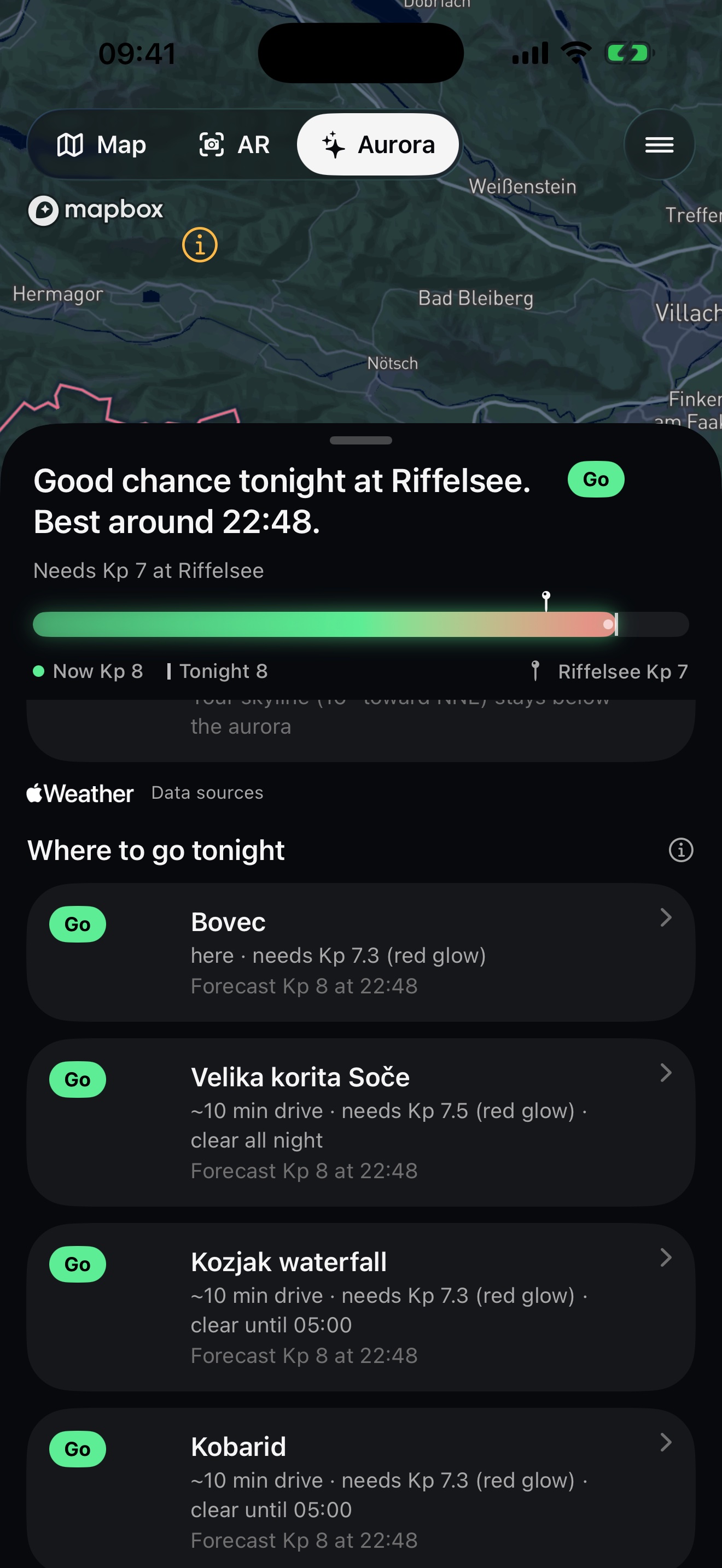
You may use the logo, the icon and these images to write about the app. Screenshots are from the release candidate in the iOS Simulator; map and terrain credits are in the captions. Please do not alter the logo or the icon.
Contact
For interviews, review access or higher-resolution images, write to azman.jaka@gmail.com.
Jaka Azman s.p., Mala Loka 5, 1230 Domžale, Slovenia.