Sunreach
YOSEMITE · 21 JUNE 2027
Know when the light really reaches you.
Sunrise here is 05:37, but the sun reaches this viewpoint at 06:27. Scroll through one day and one night over the real terrain.
Scroll the day
or skip to the appYOSEMITE · 21 JUNE 2027
Sunrise here is 05:37, but the sun reaches this viewpoint at 06:27. Scroll through one day and one night over the real terrain.
Scroll the day
or skip to the appSUN ON THE SPOT · 3D
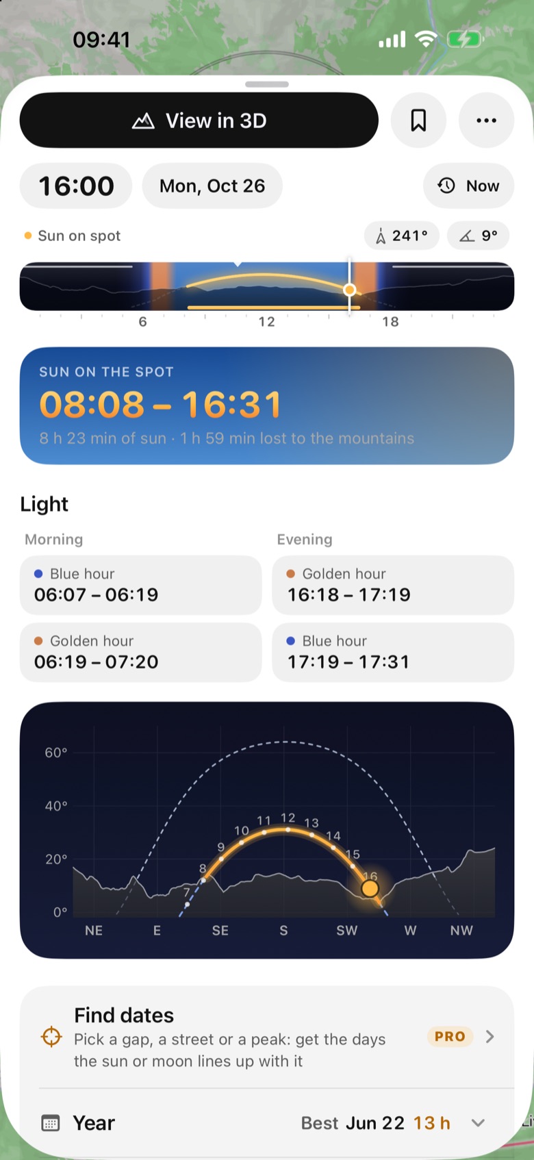
The ridge lets the sun reach this viewpoint at 06:27, 50 minutes after sunrise, and takes it back at 18:15. Gold where the sun is on your spot, blue where the mountains hide it: 11 h 47 min of sun, 2 h 59 min lost to the terrain.
EYE LEVEL · AR
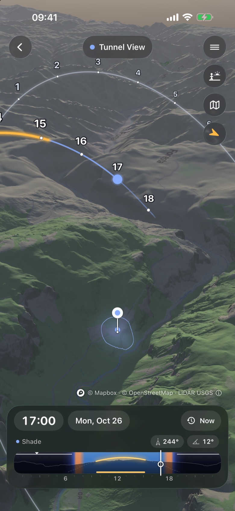
Toward the setting sun the ridge stands 22.8° high, so direct light ends at 18:15, 2 h 9 min before the 20:24 sunset. On location, AR draws the same path over your camera.
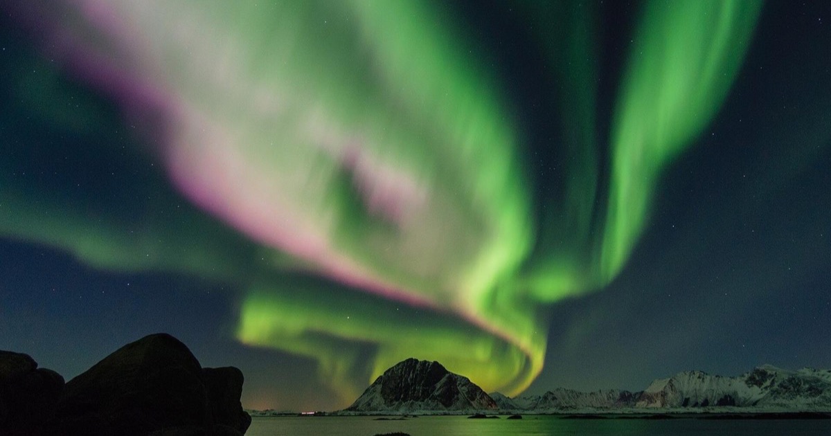
NIGHT SKY · AURORA
Stars, the Milky Way and the aurora over your real horizon: NOAA’s live forecast, the Kp your own spot needs over its skyline, and where to drive tonight. Pictured: a strong storm, simulated.
THE DIFFERENCE A MOUNTAIN MAKES Sunrise is 05:37. Sunlight reaches this spot at 06:27.
Tunnel View · 21 June 2027 · Local time
Calculated for the viewpoint, not the distant peaks. Terrain: Tilezen / USGS. Clear-sky geometry; clouds can still block the sun.
3D TERRAIN PLANNING. AR ON LOCATION.
Follow the sun’s path over mountains, valleys and your exact viewpoint.
Pick a place and a date. Follow the sun over real terrain in 3D, watch mountain shadows move, then use AR on location to see the sun’s path over your live camera view.
FROM THE APP / GREAT SOČA GORGE
Drag the time. In the Great Soča Gorge on 18 October the sun reaches the water at 10:27 and leaves it at 14:59.
The sun tracker connects the sun’s direction and height with the ground around you. This is the iPhone app over 2 m laser-scan terrain in Slovenia.
Take a look around YosemiteApp screen recording · Pre-release build · 24 October 2026
TWO VIEWS. ONE LIGHT PLAN.
Explore a place before you travel. When you arrive, see the sun’s path in the view right in front of you.
Turn the terrain, follow the sun and moving shadows, or switch to eye level to frame a place before you go. Close in over a town, the view hands over to a 3D map with the buildings and their shadows.
Try the 3D terrain demo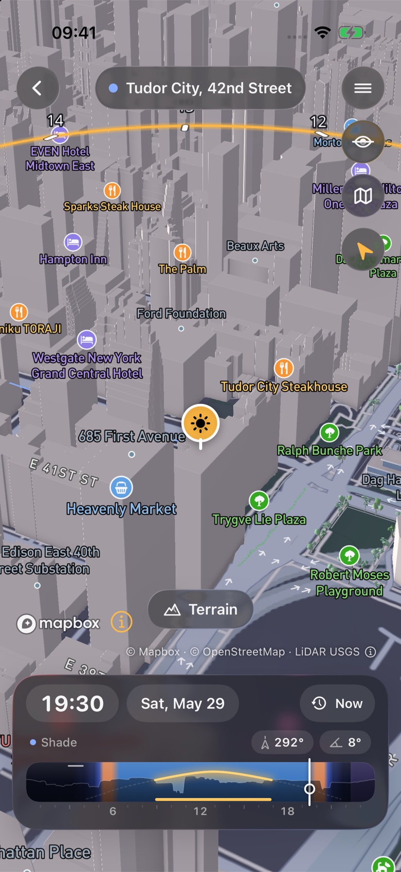
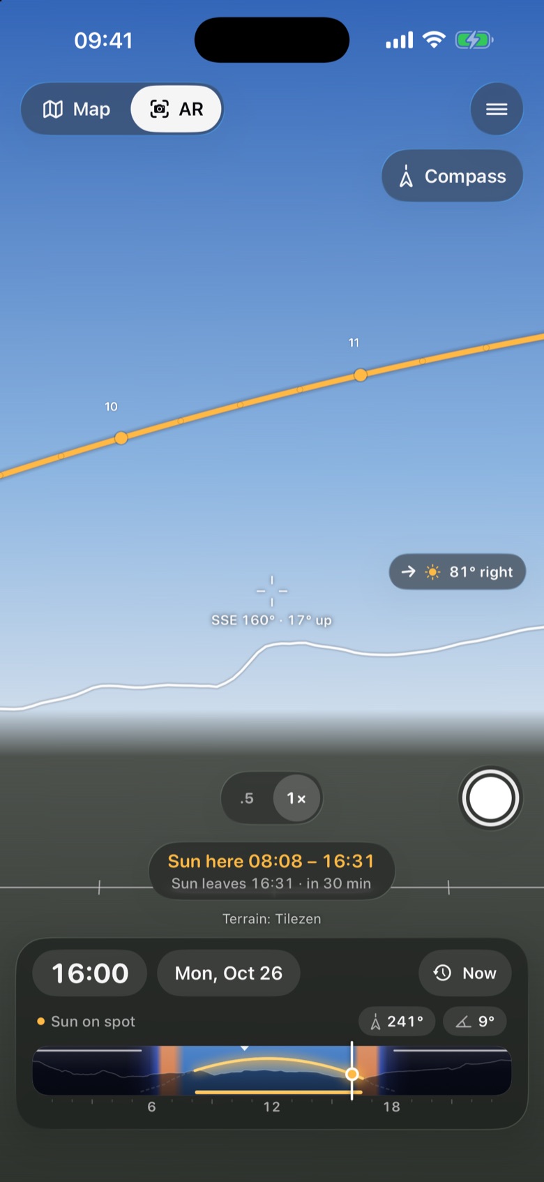
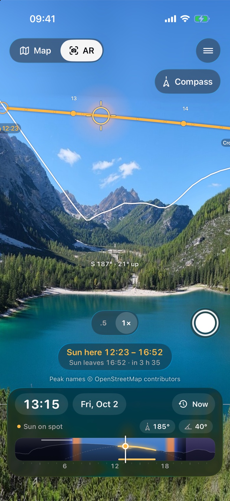
Point your iPhone or iPad at the landscape. AR overlays the sun’s path and terrain skyline on the live camera view, with the minutes the sun reaches and leaves you.
AR uses your current location and camera. It saves photos and videos with the sun’s path drawn in.
NEW / THE AURORA
Aurora apps tell you the Kp. Sunreach tells you whether it is enough where you stand, and where to drive tonight.
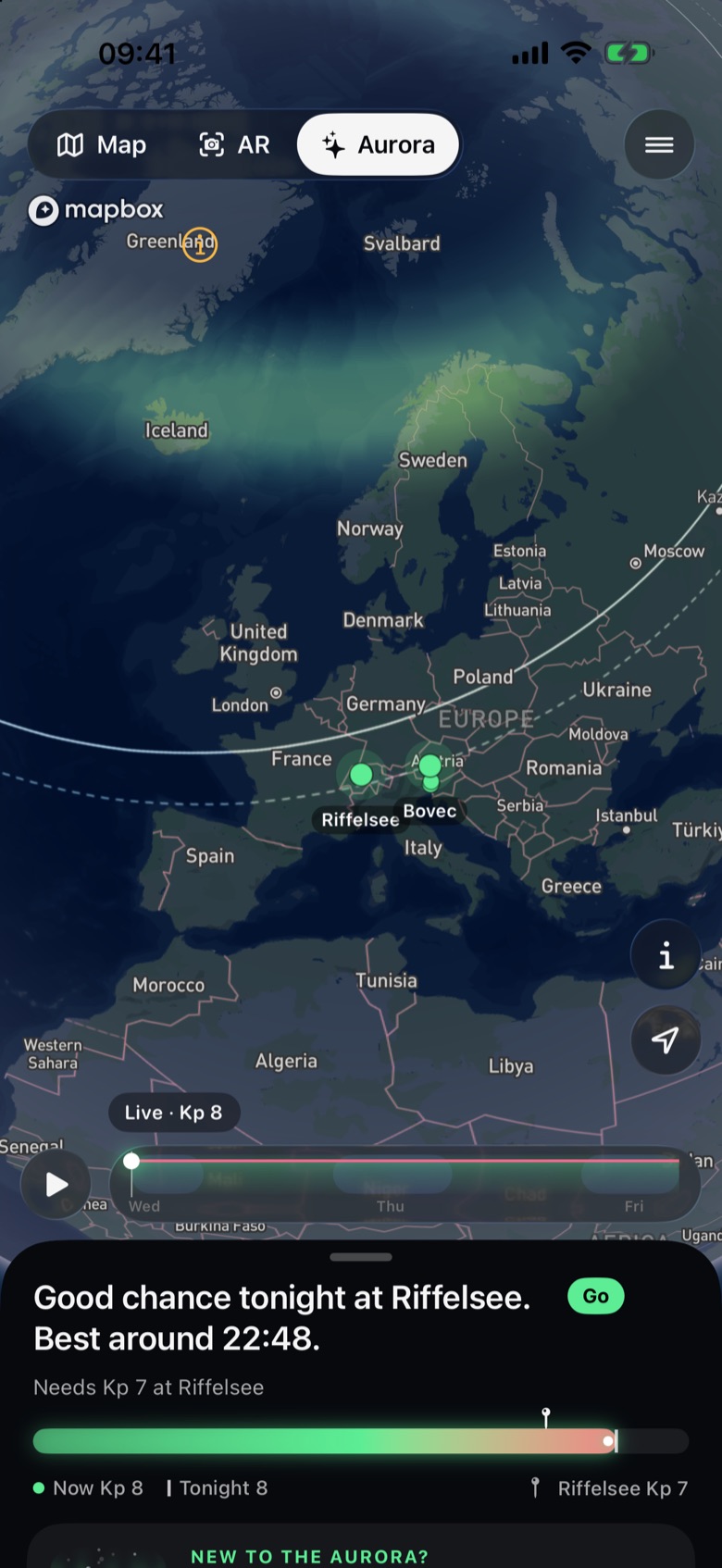
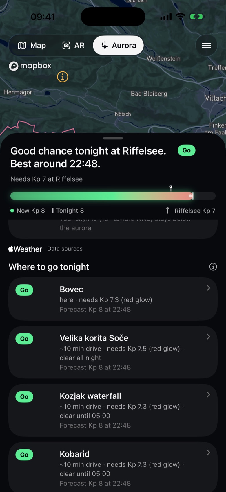
Kp from 0 to 9, computed by the app from each place’s magnetic latitude and NOAA’s Kp table. Each Kp step moves the aurora about 227 km toward the equator; the eye needs about 1.5 more. From Kp 7 the red glow, 200–400 km up, reaches farther than the green.
Left: a quiet night (Kp 0). Right: a strong storm (Kp 8), simulated for this picture. Data: NOAA Space Weather Prediction Center; Hp30 from GFZ Potsdam.
AN EXAMPLE / MANHATTANHENGE
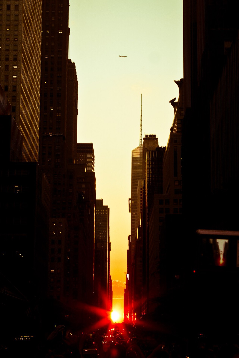
Twice a year the sun sets straight down Manhattan’s cross streets. This is how you find the evenings and the minute for your street.
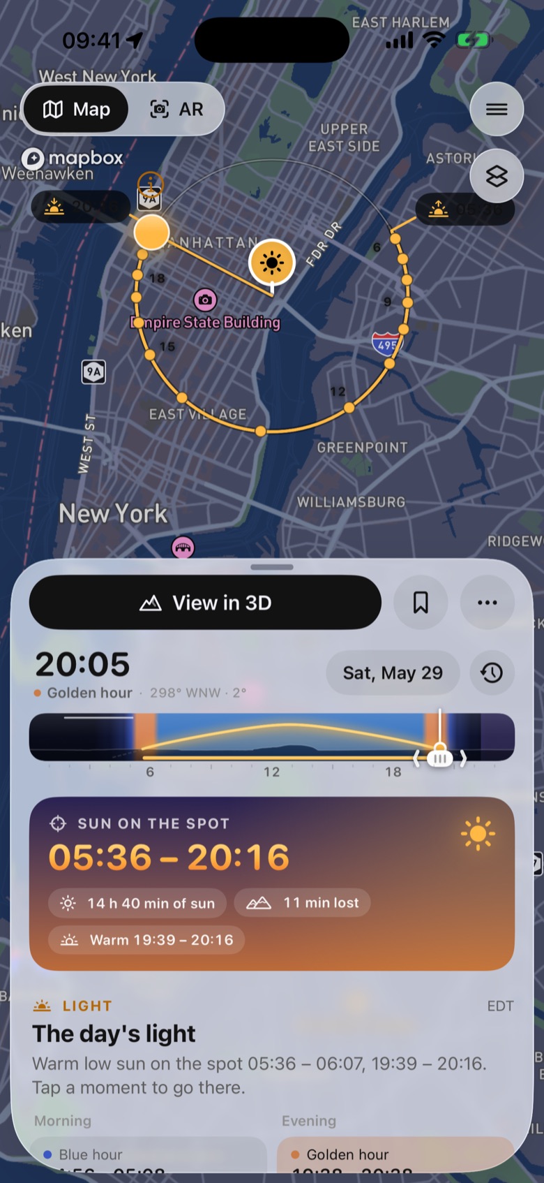
Search “42nd Street and Fifth Avenue”, or hold the map where you will stand. The plan opens with today’s sun on that spot.
Draw the street’s bearing on the map, or open 3D, go to eye level and aim down the street.
Alignment search lists the evenings the setting sun lines up: two in late May and two in mid-July, each with the minute.
Tap an evening to see that minute in the 3D city view with the buildings, then add a reminder. This year’s dates and times →
FREE AND PRO
Plan any spot on Earth for today and tomorrow at no cost. Pro plans any date and adds the tools for trips and shoots further out.
No account, no ads
€24.99 a year with a 7-day free trial, or €3.99 a month
Prices at launch in euros; the App Store shows your local price. Pro is sold through the App Store.
THE PLAN, MADE SIMPLE
Choose a place and a day, read when the sun is on it, then compare the months.
01 / FIND YOUR PLACE
Drop it on a viewpoint, a terrace or a street corner. The sun’s path and direction for any minute are drawn on the map.
02 / FIND YOUR WINDOW
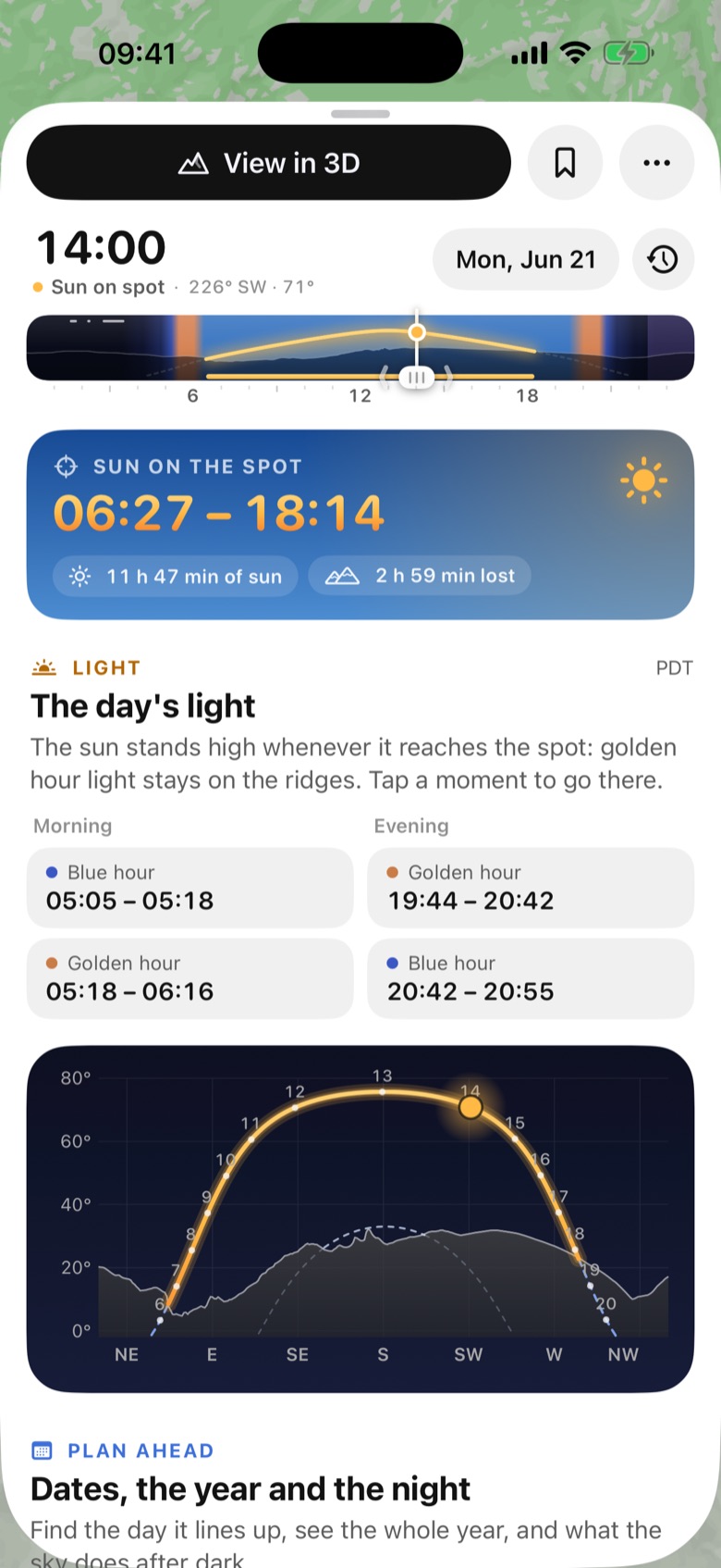
Direct sun, terrain shade, golden hour and the skyline, together in one plan.
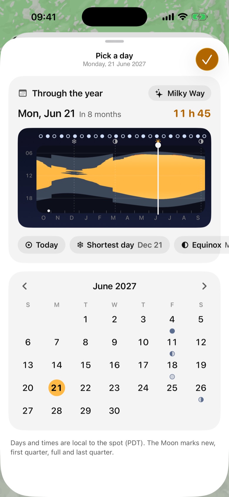
03 / FIND YOUR SEASON
Compare the months and pick a date that gives your place the light you want.
Screenshots from a pre-release iPhone build: New York on 29 May 2027, then Tunnel View in Yosemite on 21 June 2027. The map is Mapbox.
WHAT SUNREACH CAN DO FOR YOU
Plan a shot to the minute, or pick the sunny terrace and the best view of a landmark on holiday.
See when the low sun reaches your camera position, whether a mountain hides your golden hour, and where a polariser darkens the sky most.
Pick a street, a notch on the ridge or a tower. Alignment search lists the days and minutes the sun or moon sits on it.
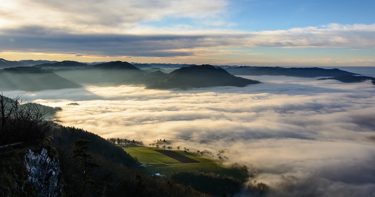
See which peaks keep the pink light after sunset and for how long, with a go or don’t-go from the clouds and a valley-fog outlook.
Walk at eye level in 3D, pick a lens from 16 to 400 mm, fly a drone camera, or open the city view with buildings.
Find the terrace that keeps the sun at 16:00, the shady side of the street at noon, or when a landmark’s front is lit.
Moon, Milky Way and the aurora: the Kp your spot needs over its skyline, where to drive tonight, and the glow over your real horizon in AR and 3D.
Download terrain, place names and a hillshade map before you lose signal.
Widgets, Lock Screen and a Live Activity keep a saved spot’s next light window in view. Light alerts can tell you before golden hour, blue hour or the sun reaching your spot.
Drag the pin on the map or in 3D. The light plan follows the position.
1,036 hand-picked viewpoints, nearest first, each with a tip for the light.
98 photo events, from Manhattanhenge to sea fog over Lake Bled, each with what you see, why it happens and how to shoot it.
Times are clear-sky geometry; the forecast decides the rest. Drone planning needs separate airspace and flight checks.
DIFFERENT PLACES. DIFFERENT LIGHT.
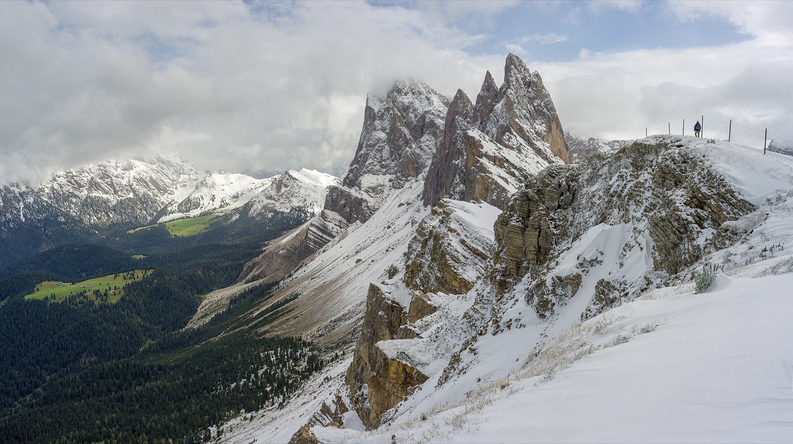
Above the valley
Read the terrain-aware light guide
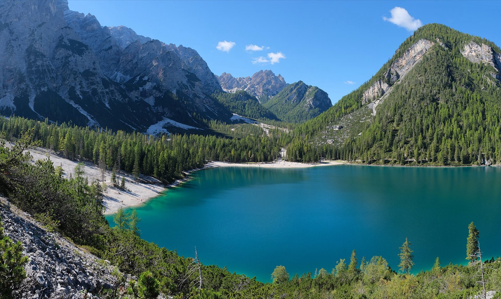
Beside the water
Read the terrain-aware light guide

Down a city street
The evenings the sun sets along the grid
REAL TERRAIN. CLEAR LIMITS.
Sunreach shows which terrain each answer uses. There’s terrain planning worldwide, with finer detail where local data is available.
Coverage, method & accuracyA 50 × 50 km area around your spot. Estimated timing accuracy ±5 minutes.
Ground models in supported areas. Spain uses 5 m data. Estimated timing accuracy ±1 minute.
Ground models describe the terrain; trees and buildings are not counted for now. Clouds and atmospheric refraction add uncertainty.
Slovenia2 m ground model within 2 km in the bundled Velika korita Soče and Ihan areas; wider coverage requires additional hosted sheets.
France2 m ground model from IGN LiDAR HD where processed sheets are available in metropolitan France and Corsica; coverage depends on published source data and available sheets.
Austria2 m ground model from BEV airborne laser scanning where processed sheets are available; coverage depends on available sheets.
USA2 m ground models within 2 km where USGS 3DEP has suitable high-resolution coverage.
Switzerland2 m ground model (swissALTI3D) fetched from swisstopo for spots in Switzerland and Liechtenstein.
Spain5 m ground model (IGN MDT05, from PNOA lidar) fetched for spots in mainland Spain and the Balearic and Canary Islands.
Germany2 m ground models from the 1 m state terrain models (DGM1) of Bavaria, Baden-Württemberg, North Rhine-Westphalia and Saxony-Anhalt; other states use global terrain for now.
Italy2 m ground model from the Province of Trento’s lidar in the bundled Pale di San Martino area (Baita Segantini); the rest of Trentino, Valle d’Aosta and Friuli Venezia Giulia require additional processed sheets.
Netherlands2 m ground model from AHN4 (0.5 m lidar), fetched for spots anywhere in the Netherlands.
Belgium (Flanders)2 m ground model from the Digital Elevation Model of Flanders II (1 m lidar), fetched for spots in Flanders; Brussels and Wallonia use global terrain for now.
Czechia2 m ground model (ČÚZK DMR 5G, from lidar), fetched for spots anywhere in Czechia.
Poland2 m ground model from GUGiK’s 1 m lidar terrain model (NMT), fetched for spots anywhere in Poland.
Norway2 m ground model from Kartverket’s 1 m national lidar terrain model, fetched for spots anywhere in mainland Norway.
Finland2 m ground model from the National Land Survey of Finland’s 2 m elevation model, fetched for spots anywhere in Finland.
Estonia2 m ground model from Maa- ja Ruumiamet’s 1 m lidar terrain model, fetched for spots anywhere in Estonia.
Trees and buildings are not counted for now: every skyline is bare ground, so a tree, roof or wall close to the spot can still block the sun.
FIELD NOTES
From any Kp in Tromsø to Kp 4.9 in London and Kp 7.3 in the Alps: what decides it, and how far ahead you can know.
Read more →Places ·
Every winter morning the low sun crosses behind the tower around 09:20–09:50. Around the solstice it sits just above the first floor.
Read more →Which summits catch the pink light after sunset, for how long, and whether a cloud bank will kill it. Plus the mornings a valley fills with fog.
Read more →Future plans, separate from current capabilities. No release dates promised.
Sunreach is a 3D and AR sun tracker for iPhone and iPad: follow the sun’s path over real terrain, check mountain shade, see the sun path over your live camera view where you stand, and know whether tonight’s aurora clears your skyline. It runs on iOS 26 or later (iPhone and iPad).
Sunrise apps give the time the sun crosses a flat horizon. Sunreach computes the skyline around your spot from terrain data and gives the time the sun clears it: in Bovec on 21 December that is 08:52 instead of 07:46.
No. It is made for photographers and travelers: anyone who wants to know when a place is in the sun, from a lakeside lunch to a winter holiday village or a sunrise hike. No camera knowledge is needed.
Slovenia: 2 m ground model within 2 km in the bundled Velika korita Soče and Ihan areas; wider coverage requires additional hosted sheets. France: 2 m ground model from IGN LiDAR HD where processed sheets are available in metropolitan France and Corsica; coverage depends on published source data and available sheets. Austria: 2 m ground model from BEV airborne laser scanning where processed sheets are available; coverage depends on available sheets. Switzerland: 2 m ground model (swissALTI3D) fetched from swisstopo for spots in Switzerland and Liechtenstein. Italy: 2 m ground model from the Province of Trento’s lidar in the bundled Pale di San Martino area (Baita Segantini); the rest of Trentino, Valle d’Aosta and Friuli Venezia Giulia require additional processed sheets. Spain: 5 m ground model (IGN MDT05, from PNOA lidar) fetched for spots in mainland Spain and the Balearic and Canary Islands. Germany: 2 m ground models from the 1 m state terrain models (DGM1) of Bavaria, Baden-Württemberg, North Rhine-Westphalia and Saxony-Anhalt; other states use global terrain for now. USA: 2 m ground models within 2 km where USGS 3DEP has suitable high-resolution coverage. Netherlands: 2 m ground model from AHN4 (0.5 m lidar), fetched for spots anywhere in the Netherlands. Belgium: 2 m ground model from the Digital Elevation Model of Flanders II (1 m lidar), fetched for spots in Flanders; Brussels and Wallonia use global terrain for now. Czechia: 2 m ground model (ČÚZK DMR 5G, from lidar), fetched for spots anywhere in Czechia. Poland: 2 m ground model from GUGiK’s 1 m lidar terrain model (NMT), fetched for spots anywhere in Poland. Norway: 2 m ground model from Kartverket’s 1 m national lidar terrain model, fetched for spots anywhere in mainland Norway. Finland: 2 m ground model from the National Land Survey of Finland’s 2 m elevation model, fetched for spots anywhere in Finland. Estonia: 2 m ground model from Maa- ja Ruumiamet’s 1 m lidar terrain model, fetched for spots anywhere in Estonia. Everywhere else: 40 m terrain everywhere (from 30 m elevation data), 50 × 50 km around the spot. Trees and buildings are not counted for now: every skyline is bare ground, so a tree, roof or wall close to the spot can still block the sun.
Free to download. Sunreach Pro at launch: €24.99 a year with a 7-day free trial, or €3.99 a month. Free plans today and tomorrow; Pro plans any date. There are no ads and no account.
It connects time with direction, height and the terrain around you. See where the sun is relative to a ridge, then check the computed sunlight intervals for your pin. Read the 3D sun path guide.
On location, AR draws the sun’s path and the terrain skyline over your live camera view and lines itself up on the sun or the skyline. It is for where you stand; to explore a place before you travel, use eye level in 3D.
Yes. The map shows the sun’s direction for any minute, so you can see when it lines up with a street. Over a town the 3D view hands over to a 3D map with buildings and their shadows for the minute you pick. The sun-on-spot times count the terrain, not the buildings, for now. How to use it in a city.
Yes. It shows NOAA’s live aurora oval and forecast, and works out the Kp your own spot needs over its skyline: on open ground a camera needs about Kp 4.9 in London and Kp 7.3 in the Slovenian Alps. It ranks spots within a drive for tonight and sends alerts. Kp by place.
Yes. Alignment search takes a street, a notch on the skyline or a tower and lists the days and minutes the sun or moon lines up with it, for example Manhattanhenge or the sun behind the Eiffel Tower.
Yes. Golden hour describes the sun’s height in the sky. A mountain can still hide that low sun from your spot. Check whether the golden-hour window overlaps the direct-sun window.
No. They describe clear-sky geometry using the selected terrain model. Clouds, haze and obstacles missing from the model can change the light you actually see. See the accuracy and data limits.
Not yet. Sunreach is coming soon to iPhone and iPad. Join the waitlist and we email you on launch day. The screenshots show a pre-release build.
Yes: open the separate 3D demo ↗ for a preset Yosemite example. The full app is for iPhone and iPad; an Android release is not announced.
FIND YOUR MOMENT
Move the sun over Tunnel View in your browser
and see what El Capitan does to the morning.