 Sunreach
Offline maps: plan without signal
Mountains and signal rarely go together. Download the area around a spot before you go and Sunreach keeps working there: the skyline, the sun on the spot and a relief map drawn from the same terrain.
Part of Sunreach Pro.
Sunreach is coming soon to iPhone and iPad; screenshots are from the iOS Simulator, 26–27 October 2026.
What it does
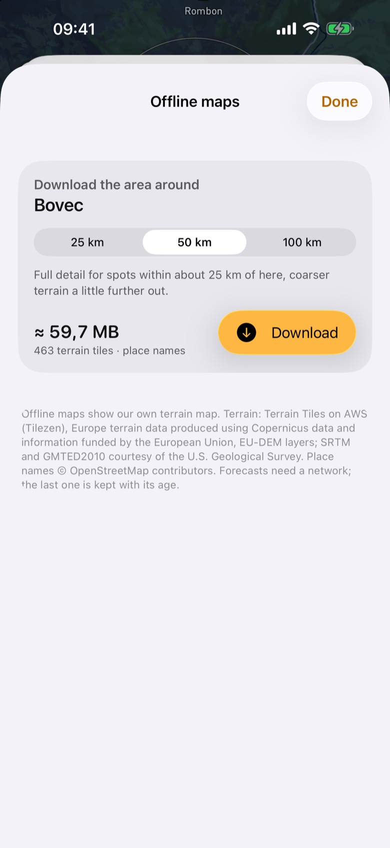
Choose a radius of 25 km, 50 km or 100 km and see the size before you download (about 23 MB and 60 MB for 25 and 50 km around Bovec). A pack holds terrain tiles, coarser terrain a little farther out, place names and lidar sheets where we host them.
Offline, the map switches to Relief (offline): our own shaded relief drawn from the downloaded terrain, with place names.
How it works
Weather cannot be offline. The last forecast is kept and shown with its age.
How to use it
- Open a spot and tap … > Download for offline (or ☰ > Offline maps).
- Pick a radius and tap Download. You can leave the sheet; partial downloads can be resumed.
- Find your packs under On this phone: tap View to go there, swipe to delete.
Tips
- 50 km covers spots within about 25 km of the centre in full detail: enough for a valley base and its viewpoints.
Good to know
- Search needs a network; offline, open saved spots or touch and hold the relief map.